TURNING BEACH WALKS INTO REAL DATA
Help Measure The Change. Be Part of the Solution.
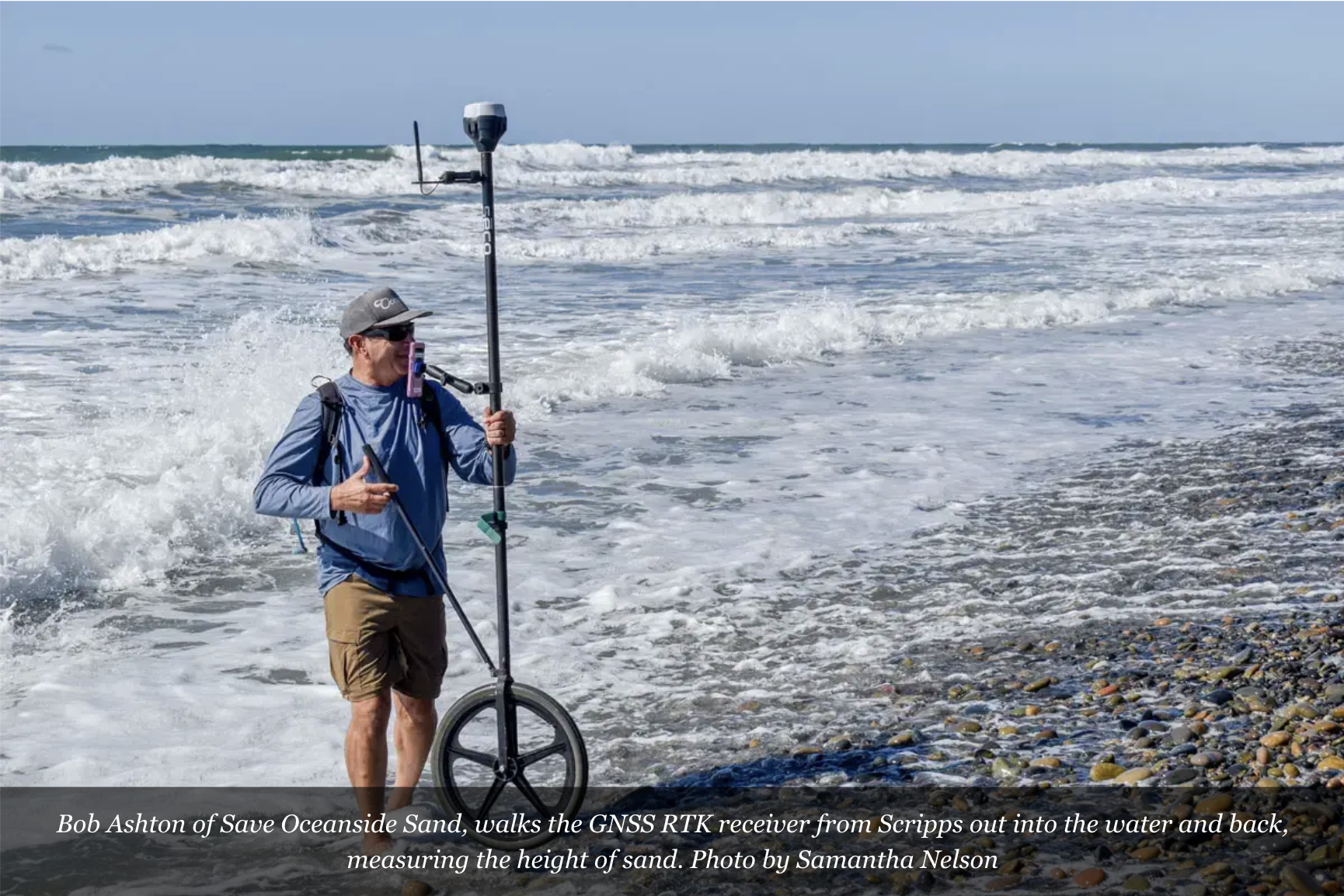
The SOS Community Science Program gives volunteers the tools and training to measure and monitor the state of Oceanside’s beaches.
By collecting sand level data (called transects) each month along our 3.7-mile shoreline, community scientists help track erosion, sediment movement, and beach health over time.
This data is used by coastal experts at Scripps Institution of Oceanography, GHD Engineers, and other agencies working on shoreline solutions — including the City of Oceanside’s ongoing sand study. It also lives on a public platform, helping researchers and engineers across the region.
No science background needed — just enthusiasm and consistency. We'll provide the training and equipment.

This work is done in collaboration with the Scripps Institution of Oceanography. The data is placed on a public access website used by engineering firms, the USACE, and others studying the Oceanside shoreline and developing potential solutions.

See Oceanside beach profiles on the Scripps Institution of Oceanography Coastal Processes Group website - here.

If you’re an enthusiastic beach-goers interested in science, we can use your help.
No previous science fieldwork is needed, we will train you.